×

HOW TO CONTRIBUTE

1 Arrange Your Information
2 Categorize as Article, Photo, News
3 Send it to Us

If you still have problems, please let us know, by sending an email to admin@ingiriyacity.lk. Thank you!

HOURS

Mon-Fri 9:00AM - 6:00PM

FORGOT YOUR DETAILS?

Ingiriya

Ingiriya can be accessed via the A8 Rathnapura - Panadura highway (33km from Panadura, 35.8km from Rathnapura), by Padukka - Ingiriya Road (16.80km from Padukka, 18.20km from Meepe) or by the Egaloya - Ingiriya Road (9km from Egaloya). Ingiriya is one of the borders of Kalutara District and Western Province. Ella, the next town after Ingiriya towards Rathnapura side, belongs to Ratnapura District, Sabaragamuwa Province and Padukka, the next town after Ingiriya towards Padukka side, belongs to Colombo District.

Location

''Ingiriya'' is a developing city in Sri Lanka. It is situated in Kalutara District of Western Province, Sri Lanka. It is situated near the border of Western Province, and Sabaragamuwa Province and it is a junction which connects Rathnapura-Panadura Road,Ingiriya-Padukka Road and Ingiriya-Bulathsinhala Roads. All the Nationalities representing Sinhalese 90%,Tamils 9%, and others 1% lives in the city. Sinhalese and Tamils are high in Percentage and the city is very peaceful. In 2001, the city Ingiriya had a population of 45,726, and in 2011, it has increased to 53,287 and the area is approximately 9204 hectors. There are about 13716 families living here. This consisted of Buddhist 88%, Hindus 9%, Christians 2% and Others 1%.

  • Horana - 13.50km
  • Panadura - 33km
  • Colombo - 51km
  • Gelanigama Highway Entrance - 21km
  • Padukka - 16.80km
  • Rathnapura - 35.80km
  • Kaluthara - 40km
  • Kottawa Highway Entrance - 40km
  • Meepe - 18.20km
  • Avissawella - 43km
  • Egaloya - 9km
  • Katunayake Airport - 91km

Location

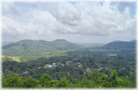
Ingiriya Town View from a Mountain Top

Location

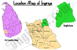
Ingiriya Location on Sri Lanka Map

Location

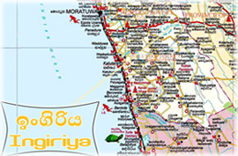
Ingiriya Location Map

Geography

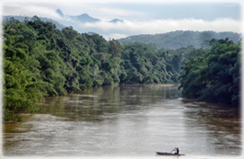
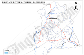
The Ingiriya city spreads starting , 24km from the sea side of the country to 8.8km to the inner side of the country. Basically, the area is full of lonely mountains and the east border contains more mountain characteristics. The highest land of the area is Madakada Giranchi Mountain with 1165 feet hight. The Eduragala Mountain is also over 700 feet in height. The eastern part contains some higher mountains over 500 feet here and there and also in western part there are same kind of mountains. But the 60% of the whole land is plain. The Kalu river flows along the southern border of Ingiriya and many streams flow from various places of the zone to Kalu River. From the eastern part it flows Nambapana stream and the largest stream of the area, Mawak Oya starts from North and flows along west side and connects to the Kalu river in the South.

Geography

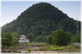
Mountain at Boralugoda

Geography

Sri Paadha Mountain View from Halwathura Bridge

Geography

Ingiriya Drainage Map

Agriculture

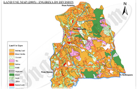
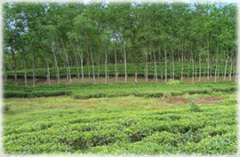
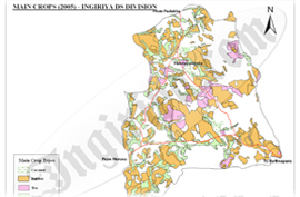
Ingiriya belongs to the Low Country Wet Agricultural Zone. The annual rainfall rate is about 4200mm and the annual temperature is about 29-75 Celcius. Ingiriya gets rainfall from both South West monsoon and East West monsoon. So the land and climate is very suitable for Cultivation. All the main Cash Crops, Tea, Rubber, Coconut and Paddy is grown in Ingiriya. As per 2009 reports there are 5039 acres of rubber plantation, 1569 acres of tea plantation, 1500 acres of coconut plantation and 22 acres of land cultivated with paddy.

Agriculture

Ingiriya Land Usage Map

Agriculture

Raigam Estate

Agriculture

Ingiriya Main Crops Map

Administration

The Ingiriya city, which is run by the Ingiriya Divisional Secretariat and Horana Pradeshiya Sabha (Divisional Council) is a part of the Horana Polling Division. Notable Government institutions in Ingiriya include:

Ingiriya Divisional Secretariat

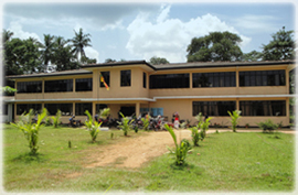
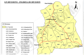
Ingiriya Divisional Secretariat office is the main administration institute that ingiriya city is ruled under. Ingiriya was a part of the Horana Divisional Secretariat earlier. In August 14th of year 2000, 31 Grama Niladhari divisions were divided and they were assigned to Ingiriya Divisional Secretariat. This change was occurred due to the large size of Horana division and the increment of the population.

Ingiriya Police Station

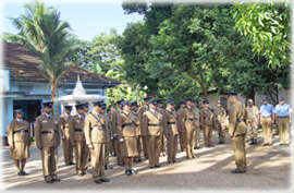
The Ingiriya Police Station which was started in 1948 plays the major role in security.

Ingiriya District Hospital

The government health services of Ingiriya are supplied by Ingiriya Medical Officer of Health office and by Ingiriya District Hospital. The prevention process is done by the Ingiriya Medical Officer of Health office and by treatments are done by the Ingiriya District Hospital.

Ingiriya Medical Officer of Health

The Medical Officer of Health (MOH) office is the the main preventive medicine center for public health activities in the region, situated at Horana Road in Ingiriya town.

Ingiriya Post Office

The Main Post Office is situated in the Ingiriya town which is an A grade Post Office. Other Sub Post Offices are situated in surrounding areas.

Ingiriya Co-operative Services

There is a Fuel Station in the town which is run by Ingiriya Co-Operative Office and another 2 private fuel stations at Handapangoda and Eduragala.

Administration

Ingiriya Divisional Secretariat Office

Administration

Ingiriya Police Station

Administration

Ingiriya Grama Niladhari Divisions Map

Transportation

Ingiriya city is located along Panadura and Rathnapura A8 Road. The Padukka-Ingiriya Road connects the A8 road at Ingiriya Junction. There is a unfamous road heading Ingiriya from Egaloya of Bulathsinhala-Horana Road. There are 3 ways to visit Ingiriya. They are, the Rathnapura-Panadura Road, Ingiriya road which starts at Padukka and Hanwella and the Egaloya-Ingiriya Road. There are two Bus Stands in Ingiriya city. All the buses which travel along A8 road parks at the new bus stand along A8 road. All other buses park at the old bus stand along Ingiriya-Padukka Road.

Buses Start from Ingiriya

  • 449 - Horana-Ingiriya
  • 125 - Colombo-Ingiriya (via Godagama)
  • 491 - Rathnapura-Ingiriya
  • 285 - Bulathsinhala-Ingiriya (via Egaloya)
  • 686 - Keenagahawela-Ingiriya (via Nachchmale)
  • 885 - Gawaragiriya-Ingiriya
  • 125 - Maharagama-Ingiriya
  • 885 - Dumbara-Ingiriya

Buses travel across Ingiriya

  • 450 - Rathnapura-Panadura
  • 064 - Panadura-Badulla
  • 457 - Ambilipitiya-Sooriyawewa
  • 449 - Karandana-Horana
  • 064 - Panadura-Ampara
  • 120 - Kalawana-Colombo
  • 064 - Panadura-Mahiyanganaya
  • 064 - Aluthgama-Balangoda
  • 190 - Bulathsinhala-Colombo

Transportation

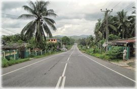
Rathnapura-Panadura A8 Road

Transportation

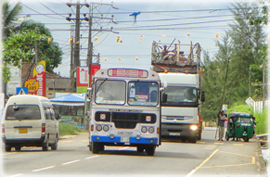
Rathnapura Panadura Bus on Road

Transportation

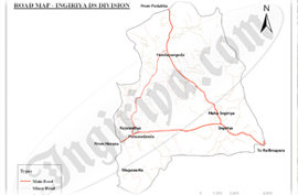
Ingiriya Road Map

History

Ingiriya can be described as an area consisted with beautiful water bodies, mountain ranges, plain lands and other attractive physical features. One of the four main rivers, the Kalu River flows from Sabaragamuwa Province to Kalutara passing Ingiriya. As the boundary (Ima) of the Sabaragamuwa Mountain ranges end at Ingiriya, it is said in the folklores that “Imagira” became Ingiriya later. The main town of the area Ingiriya can be denoted as a city which was born in the beginning of Plantation Colonization of the British Rulers. The Urugala and Nambapana areas of Ingiriya have a history which relates to the Kings who ruled near Kalu River.

A Beautiful Environment is owned by Ingiriya which have a great historical value. This Area contain many Temples and Aranya Senasanas. As a small amount of population of Hindu religion, Tamil people live in the Plantation Estates there are some Hindu Kowils to worship their Religion and there is a Christian church also situated in Ingiriya. This shows that there are people of different Nationalities and different Religions living in this area. They are very peaceful people who always expect the development of the area.

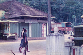
When we go through the History of Ingiriya, we can find that there were people living in this area for a long time as they are recorded in the historical writings. It can be clarified by the an Income Report of Portuguese written in 1599 about the revenue they collected from nearby places like Munagama, Wagawatta, Kekuladola. The present road of Rathnapura – Panadura which runs through Poruwadanda has historical evidences of usage even before 186 years. A British Doctor named John Dave has travelled to Adams Peak in 1817 from Panadura via Horana, Rathnapura and Palabaddala. He has described the beauty of Ingiriya area as he travelled in this road and he has clearly stated it in his writings.

History

Near Ingiriya Bo-Tree

History

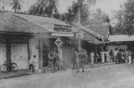
Near Ingiriya Police Station

History

Near Ingiriya Public Library
TOP